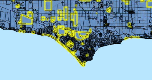
In today’s data-driven world, maps play a crucial role in various applications like Ùmap, from navigation systems to geographical analysis. With the advent of spatial databases, querying maps with SQL has become increasingly common and efficient. This article explores the intersection of SQL and maps, delving into how SQL can be used to query spatial data effectively.
Understanding Spatial Data
Spatial data refers to information that has a geographical or spatial component. This data typically represents the location and shape of objects such as points, lines, and polygons on the Earth’s surface. In databases, spatial data is stored in specialized data types optimized for spatial operations.
The Role of SQL in Querying Maps
SQL (Structured Query Language) is a powerful tool for managing and querying relational databases. While SQL was originally designed for handling tabular data, it has evolved to support spatial data types and operations. Many modern relational database management systems (RDBMS), such as PostgreSQL and Oracle Spatial, include extensions for working with spatial data using SQL.
Basic Spatial Queries
One of the fundamental operations when querying maps with SQL is selecting spatial data based on location. This can be achieved using SQL’s spatial functions and operators. For example, to retrieve all points within a specific area, you can use the ST_Within function in conjunction with a polygon representing the target area.
Advanced Spatial Queries
Beyond basic spatial queries, SQL also supports a wide range of advanced operations for analyzing and manipulating spatial data. These include buffer operations, spatial joins, and nearest neighbor searches. For instance, you can use the ST_Buffer function to create a buffer zone around a point, line, or polygon, which is useful for proximity analysis.
Spatial Indexing
Efficient querying of spatial data often relies on spatial indexing techniques. Just as traditional databases use indexes to speed up searches, spatial databases use spatial indexes to accelerate spatial queries. These indexes organize spatial data in a way that facilitates fast retrieval based on spatial relationships.
Optimizing Performance
When working with large datasets, optimizing query performance is essential. Several strategies can be employed to improve the performance of spatial queries, such as indexing, clustering, and partitioning. By carefully designing database schemas and query execution plans, you can ensure that spatial queries are executed efficiently.
Integration with Geographic Information Systems (GIS)
While SQL provides powerful capabilities for querying spatial data, it is often used in conjunction with Geographic Information Systems (GIS) for visualization and analysis. GIS software, such as QGIS and ArcGIS, complements SQL by providing interactive maps, geoprocessing tools, and spatial analysis capabilities.
Challenges and Considerations
Querying maps with SQL presents several challenges and considerations. One common challenge is the complexity of spatial data models, which can vary depending on the application domain. Additionally, ensuring data quality and accuracy is crucial when working with spatial data, as inaccuracies can lead to misleading analysis results.
Conclusion
In conclusion, querying maps with SQL offers a powerful and efficient way to analyze spatial data within relational databases. By leveraging SQL’s spatial functions and operators, developers and analysts can perform a wide range of spatial queries, from basic selection to advanced analysis. When combined with spatial indexing and optimization techniques, SQL becomes a valuable tool for working with maps in various applications. As the demand for spatial analysis continues to grow, mastering SQL for spatial data manipulation is becoming increasingly important for data professionals.


